1- LRIT SystemAlexandria Port Authority uses the Egyptian National LRIT Data Center which enables the port operators to track the vessels flying the Egyptian flag worldwide 24/7 and vessels flying foreign flags in the coastal and port areas along with responding to any SAR request. The data center feeds 6 terminals in 6 entities that are entitled to monitor and ensure vessels’ safety such as, The Search and Rescue Center and the Egyptian Maritime Safety Authority.
Figure 1: LRIT System
2- Automatic Ship Tracking System (AIS)Alexandria Port Authority has an AIS station that allows for tracking the vessels moving within the port area 24/7. The vessels are monitored and directed accordingly by a team of professional operators. In addition, the station is connected to the operations center at the Maritime Transport Sector which integrates the data of all ports of Egypt so as to provide a holistic view of the vessels in the Egyptian water.
Figure 2: AIS terminal
3- AIS-GISAlexandria Port Authority has developed a system that integrates AIS and GIS systems in order to provide complete information to the operators. The AIS system provides a rich interface with newly added features such as filtering, sorting and playback of previously logged vessel movements. The GIS system provides up-to-date visual information about the depth of berths, the port yards classified based on their status, etc. Such features improved the reliability and visibility of port resources and allows for better monitoring.
 Figure 1: LRIT System
 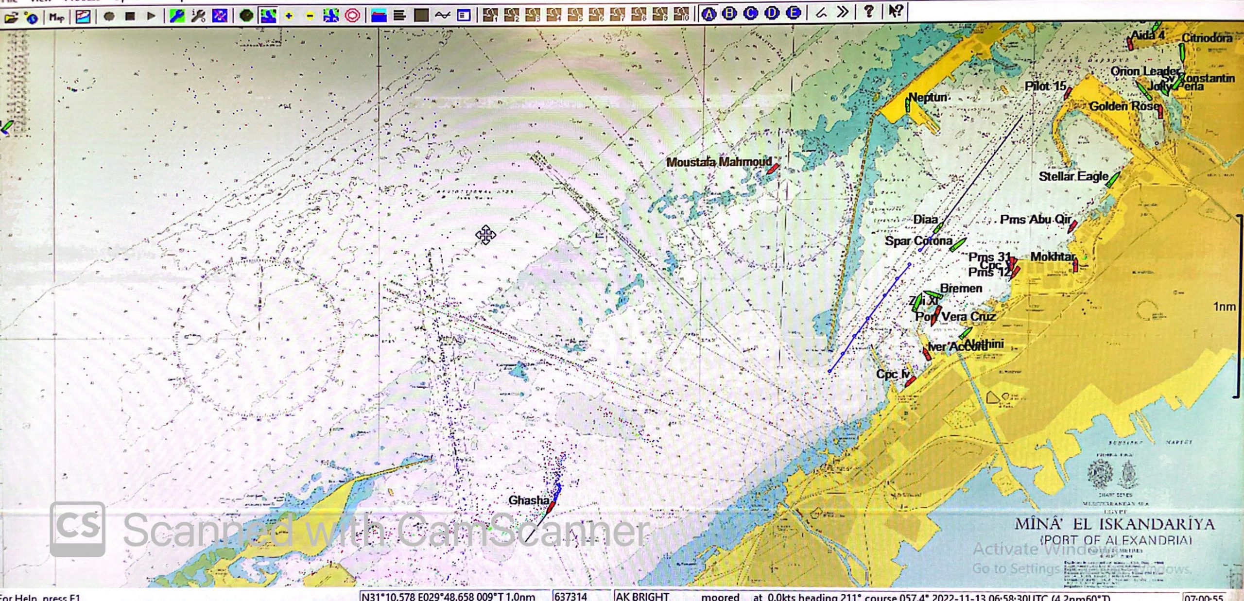 Figure 2: AIS terminal
 Figure 3: AIS-GIS system